Climate expert warns strong chance SoCal could experience ‘wettest winter on record’
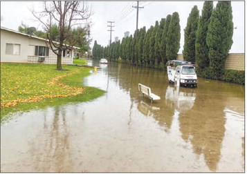
SoCal rain expected to peak in November and December, then persist through March
by Emma DiMaggio
Communications Manager
Climate scientist Dr. Daniel Swain warned city officials of the potential for Southern California’s “wettest winter on record” during a Sept. 14 presentation to the Seal Beach City Council.
“We are in rare, if not unprecedented, territory,” said Swain, a research partner with the National Center for Atmospheric Research who focuses on extreme weather conditions.
El Niño is the warm phase of the El Niño–Southern Oscillation, an oceanatmosphere climate pattern, which Swain described as an “emergency pressure valve” that allows the southern Pacific Ocean to release excess heat into the atmosphere every 2-7 years. It’s a natural climate process that is not caused by climate change. However, human-caused global warming can amplify its effects.
Current ocean temperatures in the eastern equatorial Pacific are higher than any previous calendar year on record, according to Swain: surpassing notable highs during 1982-83, 1997-98 and 2015-16. “We are well into record-breaking territory,” Swain said. “At least by this metric.”
On Sept. 10, the National Oceanic and Atmospheric Administration predicted a 75% chance of a “historic event” during the October-December season, one that could exceed the strength of previous El Niño events dating back to 1950.
The event could be record-breaking, if not “record-shattering,” according to Swain.
“In terms of precipitation, the signal is remarkably strong: it will be a very wet winter, the top 10% wettest winters we’ve ever seen,” he said. “It’s essentially unheard of to be able to have this kind of predictive confidence. It’s as strong as the predictions come.”
Though the regional El Niño weather pattern is expected to peak somewhere between October and December, the highest risk for coastal flooding in Southern California is expected to peak somewhere between December and March, he said. Some of that range coincides with California’s annual, astronomical high tides known as King Tides.
Southern California’s worst-case scenario could materialize if several factors compound one another. Global warming has already caused sea levels to rise in Southern California, increasing the risk of coastal flooding. Coastal Kelvin waves related to El Niño could temporarily raise coastal sea levels by another 6 to 12 inches. A King Tide could push water levels even higher. And if a major winter storm arrives at the same time, high tides and powerful waves—potentially intensified by El Niño—could produce“record-breaking coastal flooding,” according to Swain, but it’s too early to accurately predict whether these events will overlap.
This autumn, residents may experience “ho-hum” weather compared to December, when the “rubber meets the road,” Swain said.
“I will eat my hat if Southern California does not have a wet winter,” he said. “The question is: how wet? Destructively wet or wetter than usual? Both are likely.”
Dr. Daniel Swain shares regular updates about California weather predictions and the coming El Niño on his YouTube channel, “Weather West.” To watch his full presentation to the Seal Beach City Council, visit cityofsealbeachca.gov.
On Sept. 21, Gov. Gavin Newsom declared a state of emergency ahead of El Niño.